 | | Journal (article/letter/editorial) | | Texas mineral locality INDEX Whereas Texas is well known for its vastness, cattle industry, and oil...I T S T O P O G R A P H Y A N D G E O L O G Y , Texas, the second largest state, has produced relatively...famous localities. A s this article will show, Texas has had—or currently has—nu merous mineral occurrences...produce good specimens; yet when specimens from Texas are sought in collections and dealers' stocks, few...some basic facts that help explain the situation. Texas has very little federal land in its mineralized | 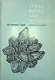 | | Report (issue) | | ¥ TEXAS ROCKS AND \ r - An Amateur’s Guide ;s ROSELLE M. GIRARD A b OF ECONOMIC GEOLOGY V N IVERSITY...The University of Texas Austin, Texas Peter T. Flawn, Director Guidebook 6 TEXAS ROCKS AND MINERALS...Rock identification charts Descriptions of some Texas rocks and minerals Anhydrite ................................................ Copper minerals (chalcocite, chalcopyrite, malachite, azurite) Dolomite ...Composition, hardness, and specific gravity of some Texas minerals Pace 25 26 39 40 43 43 43 44 45 46 47 |  | | Journal (article/letter/editorial) | | HayesandEinaudi,1986). Clark and Scottand Kidson,1977). The mine area lies approxde la Fuente(1978) recognizeda northwest-trending...Chihuahuatroughalongdebed sequences in Trans-Pecos Texas(Price, 1982, collementsin underlying Jurassicevaporites...thicknessof at least 1,200 m. The basalCretaceous in the mine area are consistent with this east-northeast La...COMMUNICATIONS NEW MEXICO i "•,•I Paso TEXAS •5•Hazel Plata Verde N et al., 1986). The igneousrocksformed...westcoastof Mexico.The mainphase qfigneousactivityin Texas,between38 and32 m.y., involved widely scattered |  | | Journal (article/letter/editorial) | | with its representation of mining tools clearly proclaim Montana’s mining origins. Montana’s production...published describing the occurrence, collecting, mining, and cutting of the two state gemstones. Figure...2. Granville Stuart established Montana’s first mining camp at Gold Creek in 1860. Geologic Provinces...view showing the Indian Queen mine ca. 1905 at Farlin, Beaverhead County. 208 ROCKS & MINERALS Downloaded...mines at Butte in Silver Bow County and the Black Pine mine in Granite County have produced many fine crystal |  | | Book (volume) | | instance, a single Spodumene crystal from the Etta Mine near Keystone on the east side of the Mount Rushmore...beds, excavations, etc.Selenite roses. BRULE COUNTY AREA: in the Oacoma zone of the Pierre Fm. On Elm...gray Barite rosette up to 5 or 6 inches. CAMPBELL COUNTY MOUND CITY, W to the Missouri R., regional hillsides...gravels, etc.petrified wood, wood opal. CORSON COUNTY LITTLE EAGLE: area ridges, slopes, stream beds...Hounds in the United States CUSTER COUNTY AREA: The November Mine, 1.2 mi. SE of the Needles Eye Tunnel |  | | Report (volume) | | of the Fontana and Hazel Creek mines, Swain County, North Carolina, the Toncrae mine, Virginia, and the...the Stone Hill mine, Alabama UNITED STATES GOVERNMENT PRINTING OFFICE, WASHINGTON : 1963 UNITED STATES...------------------------------Geology of Swain County copper district__________________________ Sedimentary...bodY------------------------------------------------Hazel Creek mine_____________________________________________...Counties, Alabama___________________________ Stone Hill mine ___________________________________________ - - |  | | Journal (article/letter/editorial) | | ARTHUR E. SMITH, JR. 9118 Concho Street Houston, Texas 77036 ROBERT 0. FAY Oklahoma Geological Survey Norman...several counties. In addition, the TriState zinchead mining area, active for more than one hundred years, extends...as the Picher district, which is in the Oklahoma portion of the TriState. This district has probably produced...October 2014 Mineral Index by Counties Alfalfa County Carmen, 2 mi. NE of Carmen, 1 .1 mi. W of Highway...Permian-age Crisfield Sandstone: malachite. Adair County Bunch, near Bunch, secs.l.5, 16, T.14N, R.24E: |  | | Report (volume) | | it helpful to refer to Survey Bulletin 507, "The mining districts of the western United States," and to...abundant, it may have been completely exhausted by mining or quarrying. Deposits of minerals of wide distribution...because they occur in sufficient quantity to warrant mining for their usual products but because they furnish..........Mr. George H. Ashley, Washington, D. C. Texas............Dr. William B. Phillips, Austin. Vermont...See Bauxite and Hallpysite. Asbestos. Tallapoosa County, with corundum deposits near Dudleyville; not found |  | | Report (volume) | | ....................................... 102 District of Columbia ....................................248 259 269 271 275 281 r 4 CONTENTS. Page. Texas...................................................to refer to Geological Survey Bulletin 507, "The mining districts of the western United States," and to...abundant it may have been completely exhausted by mining or quarrying. Deposits of minerals that are widely...because they occur in sufficient quantity to warrant mining for their usual products, but because they furnish |  | | Journal (article/letter/editorial) | | settlement was initially spurred by the lead-zinc mining in its southwest comer, a heritage preserved by...several new localities, including the Flambeau copper mine near Ladysmith (Rosemeyer 1999, the Vulcan Materials...Racine (Scovil 1994), the pegmatites of Florence County (Koehier 1989) and the Wausau area (Falster 1987)...marcasite. A major mining district, the Upper Mississippi Valley zinc-lead district, was in these rocks...barite, and copper minerals were found. Mining in this district ceased in the late 1970s. A branch of the |  | | Book (volume) | | ASHTABULA COUNTY CONNEAUT, area pits, quarries, rd. cuts, etc.⎯cone-in-cone Calcite. CLERMONT COUNTY MILFORD...CLINTON COUNTY WILMINGTON, area of Todd’s Ford, a mineral deposit⎯Hematite. COSHOCTON COUNTY AREA, townships...CUYAHOGA COUNTY CHAGRIN FALLS (on Geauga Co. line), area quarries⎯oilstone. DELAWARE COUNTY DELAWARE...nodules⎯Pyrite (crystals sharply cubic). FRANKLIN COUNTY COLUMBUS, area countywide exposures of blue clay...HIGHLAND COUNTY SINKING SPRING, area ore deposit (most important in Ohio) ⎯Hematite. HOCKING COUNTY AREA |  | | Book (volume) | | ASHTABULA COUNTY CONNEAUT, area pits, quarries, rd. cuts, etc.⎯cone-in-cone Calcite. CLERMONT COUNTY MILFORD...CLINTON COUNTY WILMINGTON, area of Todd’s Ford, a mineral deposit⎯Hematite. COSHOCTON COUNTY AREA, townships...CUYAHOGA COUNTY CHAGRIN FALLS (on Geauga Co. line), area quarries⎯oilstone. DELAWARE COUNTY DELAWARE...nodules⎯Pyrite (crystals sharply cubic). FRANKLIN COUNTY COLUMBUS, area countywide exposures of blue clay...HIGHLAND COUNTY SINKING SPRING, area ore deposit (most important in Ohio) ⎯Hematite. HOCKING COUNTY AREA |  | | Book | | NaFe(SiOs)2. Monoclinic. Prismatic crystals. Cleaverage—district (110.) Brittle. Luster-vitreus. Color-brown or...Gives a sodium flame. Nearly insoluble. COMANCHE COUNTY: SE%, Sec. 4, T.3N., R.15W. The xtals are i to...side by granite, AGATE (See Quartz) CANADIAN COUNTY: South Canadian Rivers. In the gravel bars of...the Also in sand plant waste dumps. CIMARRON COUNTY: Secs. 7, 8, 9, 10; T.5N., R.2E. Cimarron Meredian...widely scattered in the Black Mesa area. DEWEY COUNTY: Agate is found 2 miles east of Seiling in the |  | | Report (issue) | | ,qeology.·o f The U pp.er. Mississippi Valley District I ll. -1" GkOLOGICAL I SURVEY BULLETIN ...General Geology of The Upper Mississippi ·Valley District By ALLEN V. HEYL, ERWIN J. LYONS, ALLEN F. AGNEW...features_______ Distribution of ore deposits at the district boundaries__________ Distribution of ore deposits...Mississippi Valley zinc-lead district. 26. Structure map of area east of Hazel Green, Wis. 33. Generalized...GENERAL GEOLOGY OF THE UPPER MISSISSIPPI VALLEY DISTRICT By ALLEN V. HEYL, ERWIN J. LYoNs, ALLEN |  | | Book (edition) | | YEAR 1687"—DAVID T. DAY, CHIEF OF THE DIVISION OF MINING STATISTICS AND TECHNOLOGY WASHINGTON GOVERNMENT...and consump tion, or better and cheaper means of mining, extraction, and convey ance to market, may in...correspondence has been carried on with geologists, mining engineers, and other local authorities, and various...mmed at Broken Arrow aud Trout creek, in Sc. Clair county. The strata in this field are more faulted und...prong of Canoe creek, in St. Clair county, to Ha\sop creek, in Bibb county, a distance of 60 miles. Down to |  | | Book | | stumble over a valuable nugget and stake your own mining claim? Indeed it to is, and author book Jay...prospecting, he points out, is in abandoned mining districts, where valuable mineral ores are present...commercial ores and secondary minerals by state, county, township, and geologic range. For easy identification...RANSOM 1875-1948 An to the Eastern '‘Schoolmarm” Mining Camps of the Old West I I a s I \ h K... CONTENTS Preface ix PART I 1 Introduction to Mining and Mineralogy 2 Preparation for Mineral Collecting |  | | Journal (issue) | | AND CHEMISTRY OF GOLD IN THE VlRGlLlNA DISTRICT, HALIFAX COUNTY, VIRGINIA Michael A. Linden', James R...Solberg* INTRODUCTION The Virgilina district of Halifax County in south central Virginia is a minor...well-documented gold region of the central Appalachians. The district (Figure I), which extends from Virginia into North...1917 the mines in the Virginia portion of the district produced approximately 750,000 pounds of refined...recovered primarily from the Red Bank mine and the Luce-Howard mine although numerous trenches, pits, and |  | | Report (issue) | | Geology of the Upper Mississippi Valley Zinc-Lead District By ALLEN V. HEYL, Jr., ALLEN F. AGNEW, ERWIN J...Cultural development and facilities related to mining Field work and acknowledgments Scope of the report...report Previous geologic work in the district Geology Stratigraphy Precambrian rocks Cambrian system Upper...features Regional relations Structures of the mining district Folds First-order folds Second-order folds...development of the district structures Development of the structural features within the district Origin of the |  | | Journal (article/letter/editorial) | | the information about cinnabar from the Red Devil Mine of Sleetmute, Alaska, and thought you might like...siderite have been found in the Junction copper mine, Bisbee, Cochise Co., Ariz. ARKANSAS — A black mass...sphalerite (gem quality) from the famous Big Four zinc mine near Heeney, Summit Co., Colo. Some small specimens...us — very nice material. "From the Big Four zinc mine near Heeney, Summit Co., Colo., by the Green Mountain...Mountain Reservoir. Some galena xls also found here. "Mine temporarily closed again due to low price of zinc |  | | Book | | Rhode Island South Carolina South Dakota Tennessee Texas Utah Vermont Virginia Washington West Virginia Wisconsin...photographs of gemstones were made possible by Howard and Hazel Michael, of Y reka, California, who opened their...of commercial mining is also long, beginning with the Kenya opal mines of 4000 B.C. Mining began with gemstones...gemstones, instead of metallic ores, and mining for turquoise was enormously extended throughout the...had been sending great expeditions to prospect and mine for it throughout the Sinai Peninsula since at least |  | | Journal (article/letter/editorial) | | about 35 miles northwest of Flagstaff, in Coconino County, a pineforested volcanic area. The elevation is...in California recently I visited the Los Angeles County Museum in Los Angeles to see the famous collection...in Los Angeles can walk across the lawn to the County Museum for another thrill—the display of some of...weekends. "At a mine east of Leadville (Lake Co.). Colo., almost at the end of Lake County, I found a specimen...are reported from only one mine at Mackay, Idaho. Also found at this mine are malachite, azurite, cuprite |  | | Journal (article/letter/editorial) | | world-wide locality index. The localities are listed by county, followed by a listing of the most prominent minerals...Alleghany County. Howard Freeland specimen and photo. Rutherford pegmatite in Amelia County and the Lynch...Station locality (turquoise crystals) in Campbell County, are now closed to collectors. However, landowners...(c) = currently closed to collecting Albemarle County Alberene soapstone quarry—Alberene amphiboie asbestos...pseudomorphs after pyrite, pyrite, siderite Faber lead mine—near Faber cerussite, chalcopyrite, fluorite, argentiferous |  | | Report (volume) | | ............................. .............. Chalcocite and bornite................ ...................pyrite, chalcopyrite can be distinguished from chalcocite and bornite, a determination which could not...Ill ................ ..... ......... 9 Linden mine, Wis ...--.... ............... 10 Galena, 111...111 ............... ................ 11 Hazel Green, Wis ......'.................... 19 Weardale, England...wedge-shaped crystals of the Joplin type, from Linden mine, Wisconsin. Iridescent blue and yellow tarnish. |  | | Journal (article/letter/editorial) | | when a new pocket was broken into in the Mammoth Mine, Tiger, (Pinal Company), Arizona." ARKANSAS — Another...xled cyrtolite was found last year in the Pine District, Jefferson Co., Colo., so we were informed by...locality in the State is Russell Gulch in Gilpen County. A small but very fine crystal group from Russell... June 26-29, 1952. CONNECTICUT — The old copper mine near Bristol, Hartford Co., Conn., used to produce...Chamberlin St., Orlando, Florida. "On June 17, 1952, Hazel Green and I found some casts of shells that pleased |  | | Journal (issue) | | world-wide locality index The localities are listed by county, followed by a listing of the most prominent minerals...pegmatite in Amelia County and the Lynch Station locality (turquoise crystals) in Campbell County, are now closed...(c) = currently closed to collecting ALBEMARLE COUNTY Alberene soapstone quarry-Alberene actinolite-tremolite...limonite pseudomorphs after pyrite, siderite Faber lead mine-near Faber cerussite, chalcopyrite, fluorite, argentiferous...topaz, tourmaline, triplite Trueheart pegmatite mine (f)-near Amelia beryl (var. aquamarine), microcline |
|


