| Locality type: | Village |
| Classification |
|---|
|
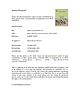
| Species: | Schorl |
| Formula: | NaFe32+Al6(Si6O18)(BO3)3(OH)3(OH) |
| Confirmation |
|---|
|
| Validity: | Believed Valid |
| Data |
|---|
|
| Mineral Data: | Click here to view Schorl data |
| Locality Data: | Click here to view Vykmanov, Ostrov, Karlovy Vary District, Karlovy Vary Region, Czech Republic |
| Data Identifiers |
|---|
|
| Mindat Occurrence Record ID: | 966192 |
| Long-form Identifier: | 1:3:966192:9 |
| GUID (UUID V4): | 4d93bac5-47fb-4376-84e3-5c5f33f03c30 |
| Nearest other occurrences of Schorl |
|---|
|
|
| 10.7km (6.6 miles) | ⓘMaurizi Mine (St. Maurizius shaft; Mauritius Mine; Beer Mine), Hřebečná, Abertamy, Karlovy Vary District, Karlovy Vary Region, Czech Republic |
| 18.7km (11.6 miles) | ⓘSlatinný potok, Nové Hamry, Karlovy Vary District, Karlovy Vary Region, Czech Republic |
| 20.0km (12.4 miles) | ⓘSchaar Shaft, Johanngeorgenstadt, Erzgebirgskreis, Saxony, Germany |
| 20.4km (12.7 miles) | ⓘHradiště, Klášterec nad Ohří, Chomutov District, Ústí nad Labem Region, Czech Republic |
| 24.2km (15.1 miles) | ⓘVýsluní deposit, Výsluní, Chomutov District, Ústí nad Labem Region, Czech Republic |
| 27.1km (16.8 miles) | ⓘŠindelová, Sokolov District, Karlovy Vary Region, Czech Republic |
| 30.4km (18.9 miles) | ⓘFahsel quarry, Blauenthal, Eibenstock, Erzgebirgskreis, Saxony, Germany |
| 31.6km (19.7 miles) | ⓘJeroným Mine, Čistá, Rovná, Sokolov District, Karlovy Vary Region, Czech Republic |
| 31.9km (19.8 miles) | ⓘTisová, Kraslice, Sokolov District, Karlovy Vary Region, Czech Republic |
| 32.3km (20.1 miles) | ⓘSteinberg, Zschorlau, Erzgebirgskreis, Saxony, Germany |
| References |
|---|
|
|
| Reference Search (possible matching items) |
|---|
 | | Journal (article/letter/editorial) | | Medium-grained Li-F granite, Krásno stock, Czech Republic (Jarchovský, 2006). K-feldspar and albite are...(K) Topaz from the Podlesí granite stock, Czech na Republic, with inclusions of quartz (Breiter et al...the Hub stock, Horní Slavkov-Krásno ore district, Czech Republic, with aggregates of polysynthetic twinned...Krásno, Czech Republic (Jarchovský, 2006); (E) Quartz-muscovite-topaz greisen from the Vykmanov granite...granite stock, Czech Republic (Štemprok et al., 2005); (F) Rock ro from the endogranitic tin zone alteration |  | | Journal (article/letter/editorial) | | extending from Belgium, in the West, through the Ruhr District, Germany, to the Upper Silesian Coal Basin, Poland...In the pegmatite No. 3 at Dolní Bory-Hatě, Czech Republic, it appears as a hydrothermal breakdown product...Nevertheless as being a common phyllosilicate also in the region under consideration it deserves a closer look at...5 presenting mineral resources of the Federal Republic of Germany (Dill and Röhling, 2007). The description...1995). In the 26 Tepla´-Barrandian unit, Czech Republic, the Neoproterozoic sediments containing muscovite |
|


