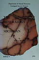
 | | Report (issue) | | (CaBSiO4OH) vesicle filling from a basaltic Houghton County lava flow. Small specks of native copper occur...the surface and between the nodular masses. The Michigan Bicentennial symbol (back cover) incorporates...Survey Division BULLETIN 6 THE MINERALOGY OF MICHIGAN by E. Wm. Heinrich Professor of Mineralogy and...University of Michigan Ann Arhor, Michigan Lansing, Michigan 1976 STATE OF MICHIGAN WILLIAM G. Mrr...State of Michigan CL '48 s.321.6. Printed by Speaker-Hines and Thomas, Inc., Lansing, Michigan. Available | 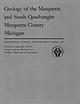 | | Report (issue) | | Geology of the Marquette and Sands Quadrangles Marquette County Michigan GEOLOGICAL SURVEY PROFESSIONAL...Division of the Michigan Department of Conservation PAPER 397 Geology of the Marquette and Sands Quadrangles...Quadrangles Marquette County Michigan By JACOB E. GAIR and ROBERT E. THADEN GEOLOGICAL SURVEY PROFESSIONAL...cooperation with the Geological Survey Division of the Michigan Department of Conservation UNITED STATES GOVERNMENT...Correlation and age relations. ____________ Kona Dolomite _ _ _________________________ Components and |  | | Book | | Mineralogy of Michigan by E. W. Heinrich updated and revised • by George W. Robinson M By E W~ Hellnr]ch...Museum Michigan Technological University Houghton, Michigan 49931 2004 © MINERALOGY OF MICHIGAN 3 FOREWORD...FOREWORD Michigan has a long and varied geologic history that includes repeated episodes of volcanism...before the first Europeans set foot here. When Michigan became a state in 1837, one of the first actions...and we continue to learn more about them today. Michigan minerals helped to build the state and nation |  | | Journal (article/letter/editorial) | | Library] at 15:24 24 November 2014 Marquctle, Michigan 49855 Specimen recovery in the Iron Country is...Peninsula (U.P.) counties (Marquette, Baraga, Iron, and Dickinson) of Michigan, plus a small portion of...northeastern Wisconsin. This includes the famous Marquette and Eastern and Western Menominee iron ranges...by boat and ship on Lake Superior. The port of Marquette was established to handle the rich ores that were...rest of the story, as they say, is history. Marquette County alone would eventually have 247 iron mines |  | | Report (volume) | | ..............j........................... Kona Dolomite (tract 11, map 1) ......................................................................... Michigan (tract 17, map 1)...............................copper deposits: carbonaceous algal dolomite (White Pine, Michigan), sandstone (Spar Lake, Montana), and...shale (Kucha, 1982)). Mineralogy and Zoning: Chalcocite is the dominant economic sulfide in most deposits...leucoxene; bornite, digenite, hematite; digenite, chalcocite, hematite. In deposits where distinctive zoning |  | | Report (issue) | | following minerals deposited in zones in this order: chalcocite and other CU S minerals, bornite, chalcopyrite...pyrite, and 2 subordinate galena and sphalerite. Chalcocite forms near the oxidized source of copper; pyrite...exposures may be completely leached. Secondary chalcocite enrichment is not present in many deposits because...involved in mining sediment-hosted copper deposits. Chalcocite and bornite in the high-grade zone are fairly...hydrothermal overprint on sedimentary–diagenetic bornite-chalcocite mineralization. Arsenic, cadmium, mercury and |  | | Journal (issue) | | GAS RECENT INNOVATIONS John C. Osmond LAND MICHIGAN 1100 Ring Building, Member— Audit Bureau of...competitors wey Often challenge but never equal. “James Bay, Canada \ i Adas Copco 70 Demarest Drive, Wayne...operating partner in venture, known as Carbon County | Coal Co., owned jointly with Rocky Mountain...investment in the partnership. Expenditures by Carbon County Coal to develop the mine are expected to approximate...acquired several related coal companies in Pike County, Ky. for about $10.5 million. Of this sum, $8 |  | | Book (volume) | | Dahlonega Co. and Rabum Co., and the McDuffie County Belt extending through portions of McDuffie, Warren...Sphalerite. BALDWIN COUNTY MILLEDGEVILLE, at state farmjasper. BANKS COUNTY COMMERCE, along Hwy. 59...along adjoining Co. linerock crystal. BARROW COUNTY WINDER, along rd. to Jefferson and 1½ mi. inside...Guide for Rock Hounds in the United States BARTOW COUNTY AREA, Saltpeter Cave, as floatjasper. CARTERSVILLE:...agate, (banded, various colors), jasper. BIBB COUNTY MACON: at Holton Quarry, 7½ mi. NWagate; N |  | | Book (volume) | | 600 to 800 feet thick in the north. ALEXANDER COUNTY FAYVILLE, area stream gravels⎯agate, jasper, rare...⎯agate, jasper; d RR siding of Clay⎯agate. CALHOUN COUNTY AREA, shores of the Mississippi R., in the Warsaw...crystals). CRAWFORD COUNTY PALESTINE, area deposits⎯Siderite. EDWARDS COUNTY AREA, T. 1 S, R. 10 E...E, regional deposits⎯Siderite. FULTON COUNTY FARMINGTON, W 6 mi. on Rte. 116 to the Rapatee No. 5 strip...mine⎯pyritized gastropods (Pennsylvanian age). GRUNDY COUNTY AREA: c Regional rd. and RR cuts and banks of Mason |  | | Book (volume) | | 600 to 800 feet thick in the north. ALEXANDER COUNTY FAYVILLE, area stream gravels⎯agate, jasper, rare...⎯agate, jasper; d RR siding of Clay⎯agate. CALHOUN COUNTY AREA, shores of the Mississippi R., in the Warsaw...crystals). CRAWFORD COUNTY PALESTINE, area deposits⎯Siderite. EDWARDS COUNTY AREA, T. 1 S, R. 10 E...E, regional deposits⎯Siderite. FULTON COUNTY FARMINGTON, W 6 mi. on Rte. 116 to the Rapatee No. 5 strip...mine⎯pyritized gastropods (Pennsylvanian age). GRUNDY COUNTY AREA: c Regional rd. and RR cuts and banks of Mason |  | | Report (volume) | | Minnesota and northern Wisconsin and Michigan. In Wisconsin and Michigan they mainly compose the cores of...Early Proterozoic Wisconsin magmatic terrane Marquette Range Supergroup and correlative rock; Archean...between Archean terranes ; extension beneath Marquette Range Supergroup shown as dashed line I 450...(Watersmeet dome; Sims and others, 1984) .in northern Michigan. Approximately 3.56 Gain age, they are locally...assigned to the Early Proterozoic Marquette Range Supergroup in Michigan (Cannon and Gair, 1970) and the |  | | Report (issue) | | (Cyprus), York Harbor, (Canada) Turner-Albright, (USA) References 3.1 (continued) Petersen and Zantop... Zn, V, U DEPOSIT DESCRIPTION Ore Minerals: Chalcocite and other Cu2 s minerals+pyrite+bornite+native...common. Deposits may be zoned with centers of chalcocite+bornite, rims of chalcopyrite, and peripheral...Secondary Chalcocite Cu, Ag, Pb, Zn (Mo, V. U) Kupferschiefer, Germany White Pine, Michigan Western Montana...Geochemical Signature; Cu Ag Examples Keweenaw, Michigan (White) Wrangellia Terrane, Alaska (Bateman) Sierra |  | | Book | | copper district of Michigan 33 35 35 Copper mining on Isle Eoyal and elsewhere Marquette iron district...developments 45 ., 45 Clinton iron ores of Dodge County, Wis 45 Paleozoic iron ores in western Wisconsin...geologic 70 knowledge 72 Bibliography 73 Michigan Northern Wisconsin Minnesota 77 Ontario 81...of the Woods district Hunters Island and Thunder Bay region Region north of Lake Superior Region northeast...Michipicoten district Region north of Sault Ste. Marie Marquette 95 96 district Menominee 96 96 97 district |  | | Report (volume) | | selected aplites and quartz veins of White Pine County, Nevada, by D.E. Lee, E.L.M. Brandt, and J.D. Gleason...micas from meta_clastic rocks of eastern White Pine County, Nevada, by D.E. Lee, R.E. Van Loenen, E.L.M. Brandt...Platinum and palladium in a mafic dike, Sanders County, Montana, by R.E. Van Loenen, Joseph Haffty, and...samples of dolomite, limestone, and shale, Davis Formation, near Leadwood, St. Francois County, Missouri...altered during diagenesis to potassium feldspar. Dolomite, calcite, illitesmectite, chlorite, and sparse |  | | Book (edition) | | Superior hematites, 125; intro ductory, 125-129; Marquette district, 129-136; Menominee dis trict, 136-139;...Great Basin, 274-279; Utah, Exam ple 35, Bingham and Big and Little Cottonwood Canyons, 274, 275 ; Example... Silver Islet, Lake Superior, 283, 284; Thunder Bay, Canada, 284 ; region of the Rocky Mountains and...Geological Survey 126 25. Generalized section across Marquette iron range, to illustrate the type of folds. After...Geological map of the western portion of the Marquette iron range. After Van Hise and Bayley 130 i7. |  | Hodges, C.A., Cox, D.P., Singer, D.A., Case, J.E., Berger, B.R., Albers, J.P. (1984) U.S. Geological Survey-INGEOMINAS mineral resource assessment of Colombia. Open-File Report Vol. 1984 (84-345) US Geological Survey doi:10.3133/ofr84345 | Report (issue) | | overlying shales may be very large (White Pine, Michigan: 500,000,000 tonnes at 1.23 percent Cu), and deposits...25 Deposit Description Emeralds in plagioclase-dolomite veins in black shale, associated with faults....shales (Angulo, 1978). Emerald-bearing oligoclase-dolomite veins occur in or near faults which cut the Cretaceous...geologic map of the Silver City Mining region, Grant County, New Mexico: U.S. Geological Survey Geophysical...copper district of Michigan, jLri White, W. S., ed., Guidebook for Field Conference, Michigan Copper District: |  | | Report (volume) | | the Goodrich quartzite, Palmer area, Marquette County, Michigan, by R. C. Vickers. --(G) Wall-rock control...pitchblende deposits in Golden Gate Canyon, Jefferson County, Colorado, by John W. Adams and Frederick Stugard...uranium deposits in the Red Desert, SweBtwater County, Wyoming, by Donald G. Wyant, William N. Sharp...in oolitic limestone near I /Tayoworth, Johnson County, Wyoming, by R. R. Guilinger and P. K. Theobald...Uranium and copper deposits, Coyote district, Mora County, New Mexico, by C. M. Tschanz_________. (M) Description |  | | Book | | Kentucky Louisiana Maine Maryland Massachusetts Michigan Minnesota Mississippi Missouri Montana Nebraska...listed by county and community, range and distance. Whenever the collector crosses a county line, he will...of the county he is entering posted alongside the highway. By looking up the state and county, the user...guide can determine the collecting sites in that county by range and distance from the major cities and...information to reach a specific spot within a particular county. Many old localities listed here have, literally |  | | Journal (issue) | | Grand Rapids to Birch Lake at the St. Louis County-Lake County line. In the east the summits are 400 feet...A common sight everywhere on the Iron Range <> DOLOMITE—This mineral has been found in vugs in the ore...Cedar Creek, southwest of Oakland Mills, in Henry County, Iowa. : Excavation for a new channel for the creek...Found in dolomitic limestone, associated with cha CHALCOCITE CHERT. Occur Ss in dolomits nestone, 1! reac...accessory minera DOLOMITE. Occurs as chie nineral in nestone, ( tic lime kine dolomite crystals nave een | 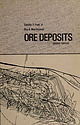 | | Book (edition) | | the brines flowing into the deeper levels of the Michigan copper mines (Lane, 1908). Connate waters are...Si02 Fe A1 89.2 7.9 293 Morgan Springs, Tehama County, California 95.4 Norris Basin, Yellowstone Park...ore deposits of the Granite Mountain area. Iron County, Utah: U.S. Geol. Survey, Mineral Inv. Field Studies...Virginia. (After Park, 1936, figure 3.) FIGURE 3-3 Big Geysers area near Healdsburg, California. The rock...examine a large thermal spring area, such as that at Big Geysers near Healdsburg, California (see Fig. 3-3) | 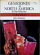 | | Book (edition) | | from the Tourmaline Q ueen .1ine, Pala, San Diego County, California. From a pen-and-ink drawing by W. E...Rodingite, Copper in Basalt, Pyrite, Calcite, •Dolomite, Mariposite, Howlite, Ulexite, Gypsum, Meerschaum...of tourmaline crystal forms 38. Map of San Diego County, California gem sources 3 9. Stewart Lithia· and...View of Clear Creek, San Benito County, California 55. Monterey County jade-producing shoreline, California...San Benito County, Calfornia E. L. Gray Opencut wall, Dallas Gem mine, San Benito County, California |  | | Report (volume) | | Boletfn de Minas, nos. 2, 8. Habana, Cuba. Delaware County Institute of Science: Proceedings, vol. 8, no....Geological Survey: Supplementary Report, Harlan County. Frankfort, Ky. Lake Superior Mining Institute:...GeoWgico de: Anales, nos. 1, 2, 4. Mexico City, D. F. Michigan Academy of Science: Report, Sixteenth, Seventeenth...Seventeenth, and Eighteenth. Lansing, Mich. Michigan Geological and Biological Survey: Publication 21. Lansing...Chicago, 111. West Virginia Geological Survey: County Reports, Braxton-Clay. Morgantown, W. 'Va. Wyoming |  | | Report (volume) | | Bulletin, nos. 16, 18. Hartford, Conn. Delaware County Institute of Science: Proceedings, vol. 5, no....Survey: vol. 9; Lower Cretaceous; Prince Georges County. Baltimore, Md. Meddelelser om Greenland, Bd. 43...28. Mexico, D. F. Michigan Academy of Science: 13th Report. Lansing, Mich. Michigan Geological and Biological...Vol. 5; Geological map (coal, etc.), 2d edition; County reports Wirt, Roan, and Calhoun counties; Jackson...Progress of the geological survey of Michigan. Geology and topography. Michigan Acad. Sci., Rept. 13, pp. 69-78 |  | | Book | | CB2 IRP 40 West 20th Street, New York, NY 10011, USA 10 Stamford Road, Oakleigh, Melbourne 3166, Australia...Aragon, Spain, zunyite for the Zuni mine, San Juan County, Colorado, clifFordite for Clifford Frondel, fleischerite...posure is in the 30,000 Island district of Georgian Bay, Ontario. (Photograph by Ed Bartram) Gems, granites...edges, and surfaces of a limestone near Brevort, Michigan. Rainwater, which is typically slightly acidic...of a banded iron formation from the Marquette District, Michigan. These alternate layers of cherty silica |  | | Journal (issue) | | today. Both are FREE. HARRY SERING 1705 East Michigan Street Indianapolis, Indiana 46201 Telephone:...and Mineral Fair will be held at the Jefferson County Fair Grounds west of Denver, Colo., on U. S. 6...1965—5th Annual Swapping Bee and Picnic of the Fulton County Mineral Club will be held at John Boyd Thacher...International Rock Swap sponsored by the Jefferson County Rock & Mineral Club on the ranch of Leslie Rose...duced by the decay of organic matter; possibly in a bay. Entire schools of hun dreds or thousands of fish |
|


