 | | Journal (issue) | | GLACIAL 13 THE POTHOLES IN MINNESOTA AND WISCONSIN, by Dr. H. W. Kuhm Of the hundreds of thousands...and other things of interest about beautiful Interstate Park. OLDEST NATURE THE PAINTINGS IN THE WoRLD...very size insures your getting nice specimens of chalcocite, bornite, chalcopyrite, laumontite, saussurite...west to the Gulf of Mexico. Minnesota and Wisconsin by Dr. H. W. KUHM THOSE READERS who enjoyed Roger...along Little Kinshew Creek near Ramsey Bar, Butte County, Cali fornia, will be interested to learn that |  | | Journal (issue) | | LOCALITIES OF MONROE, N . Y ., AND BEAR MOUNTAIN PARK. By V. L. Ayres .................................. 466 Bristol Point Amethyst Leaving Providence County, and going south. Bristol Poi!lt ,vac; v:sited...on Mineral Localities in R. I. Part I Providence County ( Fisher & Gedney) Notes on Mineral Localities...LOCALITIES OF MONROE, NEW YORK, AND BEAR MOUNTAIN PARK ind 10 I Dis the By V . L. AYRES Michigan College...Tech nology, Houghton, Mich igan Monroe, Orange County, Ne"· York, is listed in Dana's Systenz of ,\1ineralogy | 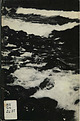 | | Report (edition) | | Louis County 32 16. Map showing many irregular lakes in terminal moraine, Otter Tail County 34 17....erratic, Duluth 158 71. Boulder till, St. Louis County 159 7£. Map showing distribution of loess in...lobe of the Cary substage 164 74. Map of late Wisconsin (Mankato) glaciation 166 75. Red glacial drift...topography, Dakota County 167 77. Terminal moraine topography, Otter Tail County 168 78. A typical...St. Louis County 199 90. Gravel of highest beach of Glacial Lake Duluth, St. Louis County 199 XVi |  | | Book | | Scientific; 93, Anthony G Taranto Jr, Palisades Interstate Park; 67 & 131, Science Photo Library; 69, Still... The Basin and Range Province of the south-west USA (right) formed in this way. and also when what are...into cracks in the Above: In California's Yosemite Park, spectacular cliffs of grey rock rear up where erosion...fractures overlying rock, Holmes in Yellowstone Park. expose several bosses on the surface, as opening...the late 1980s, seismic surveys of the Helens, USA, in 1980! The Traps’ sea floor began to reveal even |  | | Report (volume) | | described. Div. Mines, 1; Jenkins, O. P., Choctaw County, Highway 17 area: 3. Toulmin, L. D., Jr., 3. Minor:...analysis: KelH. D., 5. ler, W. D., 3. Talladega County, hematiteOklahoma, potash agstone, granite magnetite...ground water: Powham, C. E. ell, W. J., 4. Marengo County: Newton, J. G., 1. Core-drilling program, ChattanooMica:...J.,4. Excursion, Tertiary type-localiMontgomery County: Reade, ties: Rainwater, E. H. , 1. H. L. , Jr...Harris, H. B. trolled: Braunstein, J., 3. Escambia County: Cagle, J. W. ,Jr. Pollard field: Jones, W. B. |  | | Book | | Chestnutford, Bed¬ ford County, and from the Barton Tract in southwestern Floyd County is a variety of amphibole...amphibole. Apophyllite from Centreville, Fairfax County, has gained wide acclaim since its exhibition in...as the Lone Jack Quarry near Glasgow, Rockbridge County; the James River Hydrate Company Quarry, near Buchanan;...Buchanan; and the Belmont Quarry in Augusta County. Figure 1.17 illustrates several of the different...kaolinite from Cold Spring clay deposit in Augusta County, Virginia (approximately 32,000 X). (Photograph |  | | Journal (issue) | | and a mass of rose quartz of lx3 feet from Custer County, South Dakota. On slopes of Mt. Evans, Colorado...main exhibit being the minerals . found in every county of Colorado. ; Stayed in Boulder over night. Fri...obtained some tungsten concentrates from Boulder County, CoJo. rado, and some scheelite concentrates from...leaving Ward we drove to Estes Park and on through Rocky Mountain National Park to Kremmling for the night...trip, the Hamil- while collecting in Bear Mountain Park, tons made a rash statement . They were a noted |  | | Report (volume) | | cientifica Circular Classe classification Company, County Collections Committee Communications Comparative...vols. 7 (nos. 4-12), 8, 9. Grand Canyon National Park, Ariz. Grand Canyon Natural History Association...Va. Volcano Letter nos. 210-466. Hawaii National Park, Hawaii, T. H. Wagner Free Institute of.Science:...Morgantown, W. Va. West Virginia Geological Survey: County Reports, Pocahontas and Randolph; Bulletin 4; Mimeographed...3). 29 (no. 2), 30, 31. Beverly Hills, Calif. Wisconsin Academy of Science, Arts, and Letters Transactions |  | | Report (volume) | | are as follows: COLORADO. Mineralogy. Montrose County, uranium-vanadium deposits: Weeks, A. D., 13R....Kidd, D. J. Itabirite, origin of hard hematite: Park, C. F., Jr., 6. Pennsylvania, eastern: Gray, C....Iron, Cook County, titaniferous magnetite: Grout, F. F., 5. IRON. Minnesota, Cook County, titaniferous...Journal. Birmingham, Ala. Ala. Geol. Survey Bull.; County Rept.; Inf. Ser.; Map; Mus. Paper; Special Rept...Rept. Alabama Geological Survey Bulletin; County Report; Information Series; Map; Museum Papers; Special |  | | Book (edition) | | ..!°/\ { FIG. 1.2. Zion Canyon, Zion National Park, Utah. The canyon walls are made of horizontal beds...called the Mormon Temple, in Bryce Canyon National Park, Utah. This type of structure is known as an erosional...Cleveite Pitchblende Uraninite Uraninite Gilpin County, Colorado Bohemia Oslo, Norway Connecticut New...VOLCANOES FIG. 6.14. A1nboy Crater, San Bernardino County, California. This crater lies within the summit...7 or 8 feet thick, some reach 16 feet. (National Park Service.) , ........ J, - :.~ . ,..-,t ."' |  | | Book | | CB2 1RP 40 West 20th Street, New York, NY 10011, USA 10 Stamford Road, Oakleigh, Melbourne 3166, Australia...today is at the Yerkes Observatory in Green Bay, Wisconsin, man¬ aged by the University of Chicago. Its objective...(Photograph by Horace Gilmore, courtesy of Interstate Park Commission, Bear Mountain, New and averaging...which threw out 75 km3 of material. Yellowstone Park is a very large caldera, 45 x 70 km, produced by...Robert E. Wallace, U.S. Geological Survey, Menlo Park, Calif.) Until 15 million years ago, Arabia was |
|


Silver Brook copper prospects, Interstate Park, Polk County, Wisconsin, USA