| Locality type: | Lake |
| Classification |
|---|
|
| Species: | Schorl |
| Formula: | NaFe32+Al6(Si6O18)(BO3)3(OH)3(OH) |
| Confirmation |
|---|
|
| Validity: | Believed Valid |
| Data |
|---|
|
| Mineral Data: | Click here to view Schorl data |
| Locality Data: | Click here to view Heather Lake, Mount Pilchuck, Granite Falls Mining District, Snohomish County, Washington, USA |
| Data Identifiers |
|---|
|
| Mindat Occurrence Record ID: | 111785 |
| Long-form Identifier: | 1:3:111785:1 |
| GUID (UUID V4): | a044a422-06cc-471a-b194-2cc984779636 |
| Nearest other occurrences of Schorl |
|---|
|
|
| 31.0km (19.3 miles) | ⓘSilver Creek Mine, Silver Creek Mining District, Snohomish County, Washington, USA |
| 33.8km (21.0 miles) | ⓘGood Luck Prospect, Silver Creek Mining District, Snohomish County, Washington, USA |
| 46.7km (29.0 miles) | ⓘMonte Carlo Mine, Buena Vista Mining District, King County, Washington, USA |
| 47.3km (29.4 miles) | ⓘLennox Creek Roadcut, Buena Vista Mining District, King County, Washington, USA |
| 51.4km (31.9 miles) | ⓘCalligan Lake, Snoqualmie Mining District, King County, Washington, USA |
| 53.7km (33.4 miles) | ⓘBlack Dike Prospect, Miller River Mining District, King County, Washington, USA |
| 61.1km (37.9 miles) | ⓘMount Teneriffe Breccia, Snoqualmie Mining District, King County, Washington, USA |
| 68.0km (42.3 miles) | ⓘSpider Gap Schorl Occurrence, Railroad Creek Mining District, Chelan County, Washington, USA |
| 68.5km (42.5 miles) | ⓘMount Roosevelt, Middle Fork of the Snoqualmie River, Snoqualmie Mining District, King County, Washington, USA |
| 69.7km (43.3 miles) | ⓘTrinity Mine, Phelps Ridge (Red Mountain), Chiwawa Mining District, Chelan County, Washington, USA |
| References |
|---|
|
|
| Reference Search (possible matching items) |
|---|
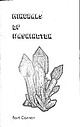 | | Book | | Bart Cannon 1975 CORD ILLERAN Mercer Island, Washington Lilli liliiiLt' 111? KLi-KlLLLIlrVlIlI Copyright...Cordilleran 18 Holly Hill Drive Mercer Island, Washington 98040 COVER ILLUSTRATION: Amethyst scepter heads...milky quartz stems. Denny Mountain area of King County. Specimen from the collection of Cary A. Maykut...publications dealing with the various aspects of Washington State's diverse mineral wealth exist, but none..."Minerals of Washington" represents an attempt to begin such a cata logue. "Minerals of Washington" shall | 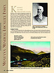 | | Journal (article/letter/editorial) | | with its representation of mining tools clearly proclaim Montana’s mining origins. Montana’s production...published describing the occurrence, collecting, mining, and cutting of the two state gemstones. Figure...2. Granville Stuart established Montana’s first mining camp at Gold Creek in 1860. Geologic Provinces...Indian Queen mine ca. 1905 at Farlin, Beaverhead County. 208 ROCKS & MINERALS Downloaded by [University...mines at Butte in Silver Bow County and the Black Pine mine in Granite County have produced many fine crystal | 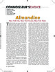 | | Journal (article/letter/editorial) | | at 14:35 04 June 2016 New York City, New York County, New York State T he minerals of the garnet group...representative of a garnet from Deshong’s quarry, Delaware County, Pennsylvania, that can barely be considered almandine...found at several mines near Topsham, Sagadahoc County, Maine, particularly the Standpipe Hill quarry...specimens have been collected at Mount Apatite near Auburn, Androscoggin County; and the Bumpus quarry, ROCKS...the Melrose and nearby mines at Stoneham, Oxford County. Phenomenal trapezohedral almandine crystals exhibiting |
|


