| Locality type: | Mine |
| Classification |
|---|
|
| Species: | 'Tourmaline' (not an IMA approved species) |
| Formula: | AD3G6 (T6O18)(BO3)3X3Z |
| Confirmation |
|---|
|
| Validity: | Believed Valid |
| Data |
|---|
|
| Mineral Data: | Click here to view Tourmaline data |
| Locality Data: | Click here to view Seelberg Mine, Niedermoschel, Nordpfälzer Land, Donnersbergkreis, Rhineland-Palatinate, Germany |
| Data Identifiers |
|---|
|
| Mindat Occurrence Record ID: | 1110009 |
| Long-form Identifier: | 1:3:1110009:6 |
| GUID (UUID V4): | f16b4f3c-6e60-4724-8743-73bb998c7bb3 |
| Nearest other occurrences of Tourmaline |
|---|
|
|
| 15.3km (9.5 miles) | ⓘMannbühl Quarry (Giro Quarry), Dannenfels, Kirchheimbolanden, Donnersbergkreis, Rhineland-Palatinate, Germany |
| 17.4km (10.8 miles) | ⓘGrüner Löwe Mine, Imsbach, Winnweiler, Donnersbergkreis, Rhineland-Palatinate, Germany |
| 18.1km (11.2 miles) | ⓘWeiße Grube, Imsbach, Winnweiler, Donnersbergkreis, Rhineland-Palatinate, Germany |
| 30.4km (18.9 miles) | ⓘHochbusch, Föckelberg, Kusel-Altenglan, Kusel, Rhineland-Palatinate, Germany |
| 62.4km (38.8 miles) | ⓘLinck marble works, Auerbach, Bensheim, Bergstraße, Darmstadt, Hesse, Germany |
| 69.0km (42.9 miles) | ⓘAorite quarry (Bitsch Quarry; Am Bannels), Erlenbach, Fürth, Bergstraße, Darmstadt, Hesse, Germany |
| 70.3km (43.7 miles) | ⓘHohe Hecke Quarry, Kallstadt, Birkenau, Bergstraße, Darmstadt, Hesse, Germany |
| 72.0km (44.7 miles) | ⓘDunkle Platte Quarry, Wembach, Ober-Ramstadt, Darmstadt-Dieburg, Darmstadt, Hesse, Germany |
| 76.3km (47.4 miles) | ⓘGabbro quarry, Bensenböhlskopf, Groß-Bieberau, Darmstadt-Dieburg, Darmstadt, Hesse, Germany |
| 76.3km (47.4 miles) | ⓘFriesenberg, Heidelberg, Karlsruhe Region, Baden-Württemberg, Germany |
| References |
|---|
|
|
| Reference Search (possible matching items) |
|---|
 | | Journal (article/letter/editorial) | | formation of the Moschellandsberg mercury deposit, SW Germany R.E. Krupp Bayerisches Geoinstitut, Universitfit...Abstract. The Moschellandsberg mercury deposit ( S W Germany) is hosted in a Permo-Carboniferous volcanic caldera...pyroclastic processes during caldera subsidence. In the Seelberg area (see Fig. 1), which is separated from Moschellandsberg...Permo-Carboniferous Saar Nahe basin of southwest Germany (Pfalz district), of which many have been known...fractures at Moschellandsberg;~ore showings at Seelberg 70 In the Moschellandsberg deposit mineralization | 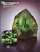 | | Journal (issue) | | Behnke Northbrook, IL Werner Lieber Heidelberg, W. Germany Eric Offermann Arlesheim, Switzerland Jeffrey A...Articles Famous mineral localities: The Kipushi mine, Z a ir e ........................................is connected by a good road to the old Kansanshi mine and the neighboring Solwezi town, about 100 km S60°W...Kolwezi, Shinkolobwe and Broken Hill. The Rokana mine is located near Kitwe. deposits in order to establish...re-exploited today, it would still be as an underground mine, despite the mechanized shovels and other heavy |
|


